Relics from the Past

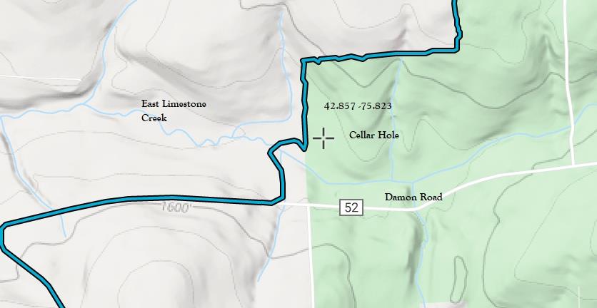
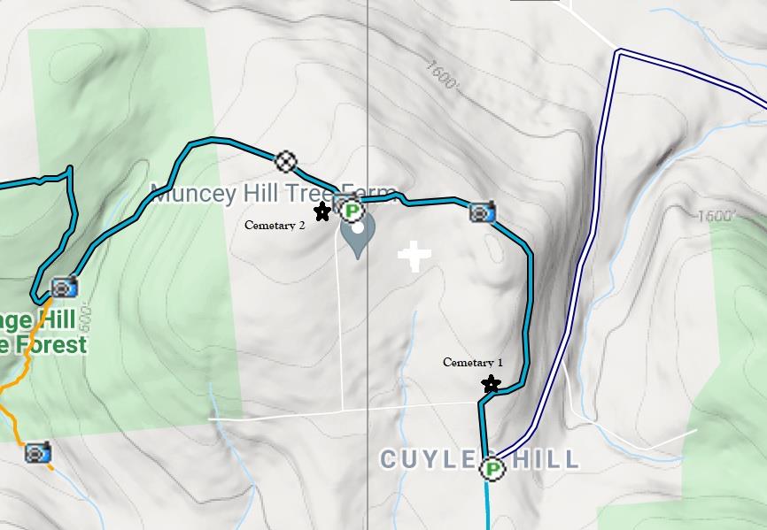
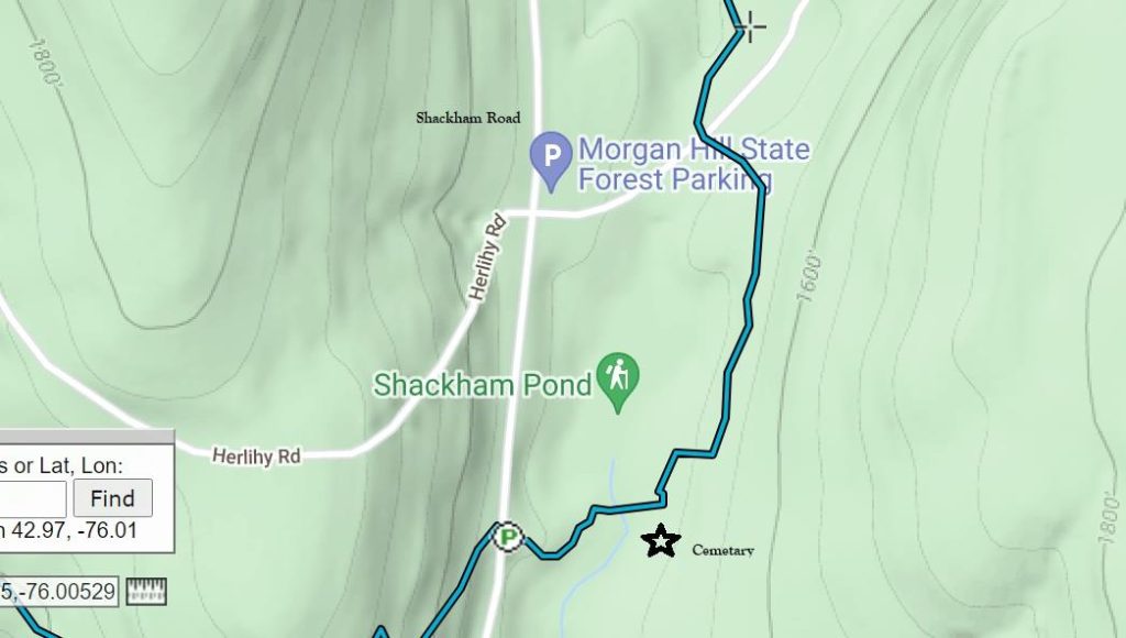
Archeology Sites in Central New York – information provided by Bill Coffin and Ed O’Shea. The following is a description of various archelogy sites on or near the Finger Lakes Trail (FLT) System in Cortland, Onondaga, and Madison counties. The latitude and longitude are approximations they should be used along with the maps and descriptions to locate the sites.

Potter Hill Cemetery is located about one mile south of where the FLT crosses Jipson Hill Road.
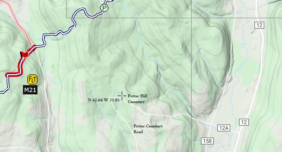
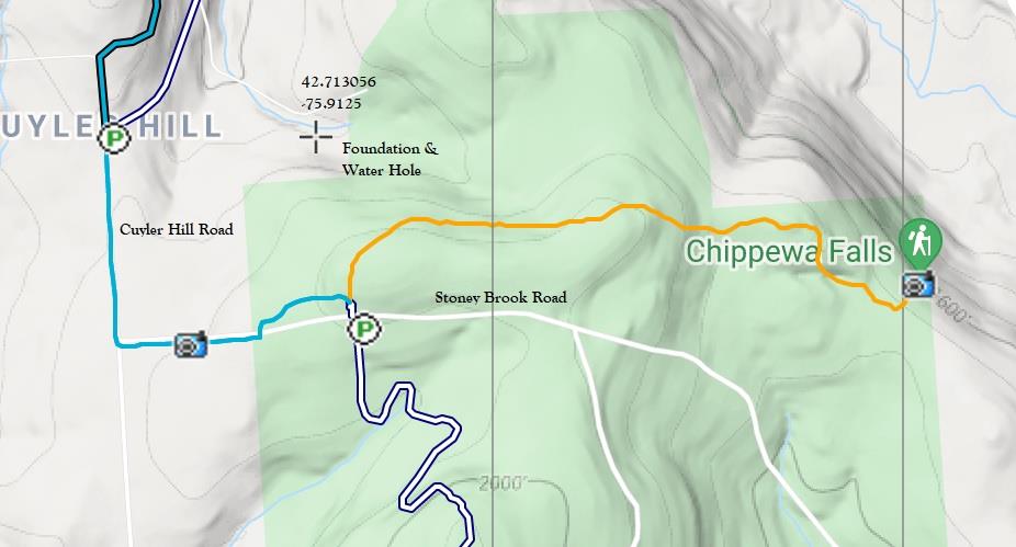
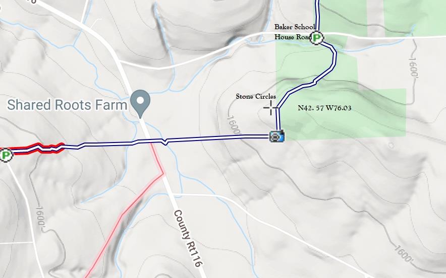
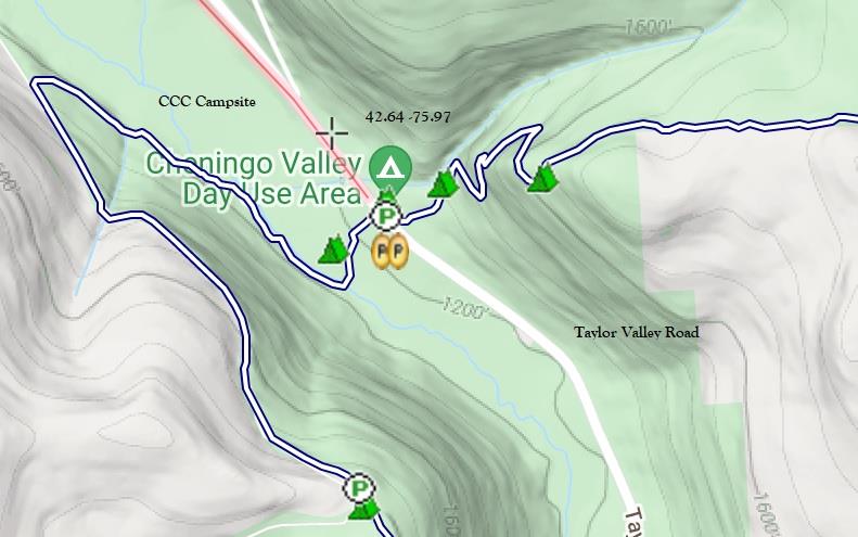
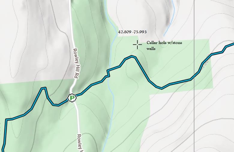
Latitude 42.64 N, Longitude -75.91 W (M21)
Randall Hill Water Hole may have been used for fire protection or for horse watering. Latitude 42.68 N, Longitude -74.91 (M21)
Enze Road Cellar Hole is a half mile west of the Randall Hill section of the FLT.
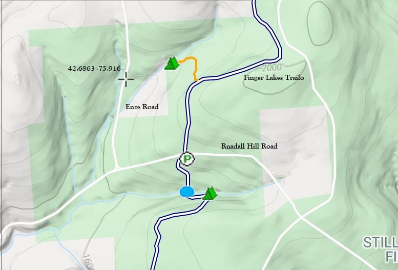
Latitude 42.6863 N, -75.916 W (M21)
Foundation and water hole is north of Stoney Brook Road. Latitude 42.713 N, -75.9125 W (M21)
Stone Circles are a short distance from the south side of Baker School House Road after crossing the stream. They are said to have been built by the CCC during the 1930’s for firefighting water. Latitude 42.57 N Longitude -76.03 W (M21)
Civilian Conservation Corps (CCC) Campsite was used in the 1930’s and is on the west side of Taylor Valley Road by the day use camp area. Latititude 42.64 N -75.97 W (M21)
Cellar Hole with stone walls is off the FLT near Rowley Hill Road. To locate the cellar hole, travel east on the trail past Rowley Hill Road and cross the stream. Head up the hill from the stream and to were the trail bends to the right. Latitude 42.81 N -75.993 W (O1)
Cellar Hole with stone walls is in Tioughnioga WMA. From the Damon Road trail access, head north and cross the East Limestone Creek. After a short distance the trail turns left and passes through an old apple orchard. Look for a small sign at the celler site on the right of the trail. Latitude 42.857 N Longitude -75.823 W (O2)
Midlum Hill Cemeteries are located on Midlum Hill. The east cemetery is located off the south side of the trail about 1/10 of mile from Midlum Hill Road. The west cemetery is at the top of Midlum Hill Road on private land a few paces off the trail near the west side of the parking area. (O1)
Shackham Pond Cemetery is to the left of the trail on a knoll by the pond shore after crossing the pond outlet stream. Latitude 42.97 N Longitude -76.01 W (O1)